Drone Photogrammetry – Unlock the Power of 3D Mapping

Drone photogrammetry is revolutionizing how industries capture, analyze, and utilize real-world data. By combining aerial imagery with advanced 3D reconstruction algorithms, photogrammetry transforms 2D drone images into accurate 3D models and maps. At ARwall, we integrate XR-driven visualization tools with drone photogrammetry to deliver immersive, precise, and interactive environments for virtual production, smart cities, architecture, and enterprise solutions.
What is Drone Photogrammetry?
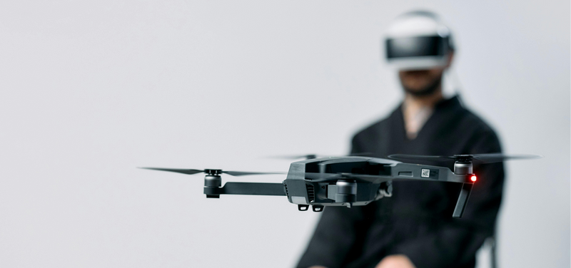
Drone photogrammetry is a technique that uses UAVs (unmanned aerial vehicles) to capture multiple overlapping images of a landscape, building, or object. These images are processed through specialized photogrammetry software to create accurate 3D models, orthomosaic maps, and point clouds.
Unlike traditional surveying, drone photogrammetry is:
-
Faster and cost-effective – Reduce field time by up to 80%.
-
Highly accurate – Achieve centimeter-level precision.
-
Safe and versatile – Map dangerous or hard-to-reach environments without risk.
ARwall takes this a step further by integrating 3D photogrammetry outputs into virtual production pipelines, allowing filmmakers, real estate developers, and enterprise clients to visualize scanned environments in real-time XR stages using ARFX Pro Plugin Suite.
Aerial Photogrammetry and UAV Advantages
Aerial photogrammetry involves capturing high-resolution images from the sky using photogrammetry drones equipped with advanced cameras or LiDAR systems. When paired with ARwall’s XR environments, these aerial datasets can power:
-
Virtual backdrops for film and TV – Replace green screens with real-world scanned environments.
-
Digital twins for architecture and smart cities – Perfect for urban planning and infrastructure projects.
-
Industrial inspections and logistics mapping – Safer, faster, and more accurate than manual methods.

UAV photogrammetry allows businesses to build a dynamic 3D database of physical spaces, which ARwall can render into immersive, interactive XR stages for creative and enterprise applications.
3D Photogrammetry and Its Role in XR
3D photogrammetry creates ultra-realistic 3D meshes and textures, forming the backbone of virtual production and interactive XR environments.
At ARwall, we use ARFX Pro and ARFX Home Studio to bring these 3D models to life, enabling:
-
Filmmakers to shoot in real-world scanned environments without leaving the studio.
-
Brands and enterprises to create interactive, photorealistic product showcases.
-
Training simulations in industries like aviation, healthcare, and manufacturing.
By merging photogrammetry 3D scanning with ARwall’s XR rendering technology, we help businesses transform static models into dynamic, real-time environments.
Best Photogrammetry Software and ARwall Integration
When it comes to processing drone imagery into 3D assets, the best photogrammetry software often includes:
-
Pix4D – Leading solution for drone mapping and 3D modeling.
-
Agisoft Metashape – High-accuracy photogrammetry for professional projects.
-
RealityCapture – Known for ultra-fast, high-quality 3D reconstruction.
-
Meshroom (Free photogrammetry software) – Great open-source option for beginners.
ARwall’s XR systems seamlessly integrate with outputs from these platforms, ensuring your 3D photogrammetry data is compatible with virtual production stages, AR platforms, and mixed reality workflows.
LiDAR vs Photogrammetry – Which is Better?
Both LiDAR and photogrammetry are widely used in mapping and 3D scanning, but they serve different needs:
|
Feature |
LiDAR |
Photogrammetry |
|
Accuracy |
Extremely high |
High (depending on method) |
|
Cost |
Expensive |
More affordable |
|
Hardware |
Specialized laser sensors |
Standard cameras |
|
Output |
Point cloud |
Textured 3D mesh + images |
Photogrammetry offers a cost-effective solution for creating textured, realistic 3D environments, which ARwall can render in XR workflows. However, for projects requiring extreme precision, ARwall can work with LiDAR data combined with photogrammetry for the ultimate result.

Photogrammetry Services by ARwall
ARwall offers professional photogrammetry services tailored for:
-
Virtual Production & Film – Scan real locations and recreate them on XR stages.
-
Architecture & Real Estate – Generate 3D property tours and immersive visualizations.
-
Industrial & Enterprise Applications – Asset visualization, training environments, and safety simulations.
We specialize in integrating photogrammetry outputs into ARFX Infinite Studio workflows, giving you a fully immersive XR solution.
Explore ARwall’s ARFX Bundles
ARwall and Photogrammetry 3D Scanning
When combined with photogrammetry scanners or UAV-based data, ARwall’s XR visualization technology enables:
-
Real-time rendering of scanned environments.
-
AR overlays for navigation and training.
-
XR experiences that reduce costs and production time.
Whether you’re using a photogrammetry drone or icam photogrammetry setup, ARwall ensures seamless integration into virtual and hybrid workflows.
Why Choose ARwall for Drone Photogrammetry?
-
Expert XR Integration – We don’t just deliver 3D scans; we create interactive XR-ready environments.
-
End-to-End Services – From drone capture to XR rendering, we manage the entire pipeline.
-
Industry Leaders in Virtual Production – Trusted by studios, enterprises, and creative agencies worldwide.
Start Your Drone Photogrammetry Project Today
Ready to turn real-world spaces into immersive XR environments?
Contact ARwall Today for a consultation on drone photogrammetry and virtual production solutions.

FAQ Section
Q1: What is drone photogrammetry?
A: It’s the process of using drones to capture images and create 3D maps or models through specialized software.
Q2: Is there any free photogrammetry software?
A: Yes, options like Meshroom provide free photogrammetry capabilities, though professional projects often require Pix4D or RealityCapture.
Q3: How does UAV photogrammetry work with ARwall’s services?
A: ARwall integrates drone-generated 3D models into XR platforms, making them usable in virtual production or enterprise simulations.
Q4: Which is better for 3D scanning: LiDAR or photogrammetry?
A: LiDAR offers higher precision, but photogrammetry is more affordable and produces textured 3D meshes, making it ideal for XR workflows.
Q5: Do you provide photogrammetry services?
A: Yes! ARwall provides end-to-end photogrammetry services including capture, processing, and XR integration.


